N56 Letterilly to Kilraine Topographical Survey
Project overview
Topographical survey of 2 sites to include the N56 road and a 100m band either side of the road including rivers and streams for hydrological modelling purposes . The project sites were 3 kms and 5kms long located on the N56 West of Glenties, Co. Donegal. The project was surveyed and delivered in 6 weeks.
Project solution
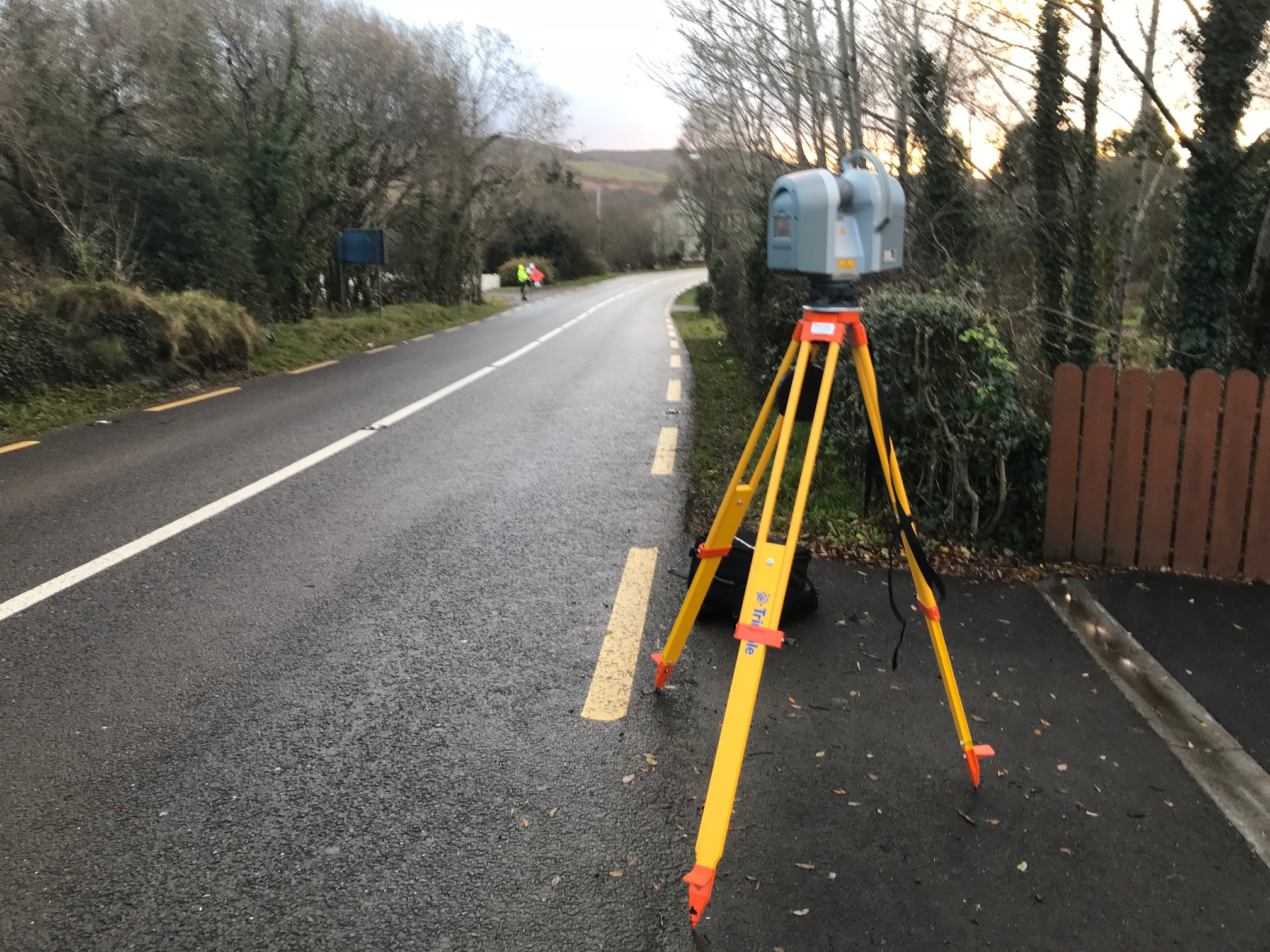
Surveys were carried out utilising a variety of methods and technologies including using precise levelling, Trimble S6 robotic total station, Trimble R10 GNSS receivers and Trimble TX8 laser scanner.
The final survey accuracy on hard detail was +/- 5mm. This was achived by using the Trimble TX8 laser scanner setup over permanent control stations installed every 100m along the route.
The final survey accuracy on soft detail was +/- 25mm. The verges, fields and water courses were surveyed using total station and GNSS methods depending on sky visibility. Conditions on the site were challenging and included a lot of bog land either side of the road corridor.
All traffic management was in compliance with Chapter 8 guidelines. The survey was carried out using a Semi Static method which meant the road was not closed at any time.
Project delivery
3D AutoCAD survey.
P,E,N,Z,D ASCII format.
Survey report with description sheets of control points.